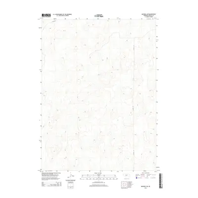
2014 Map of Maxwell NE
USGS Topo · Published 2014About this map
The rolling hills and sandy basins of central Nebraska define this landscape in the hills north of the Platte River valley. This 2014 survey focuses on a remote section of Lincoln County, where the topography consists of a complex network of dunes and depressions typical of the Sandhills region. Infrastructure is minimal in this cattle-country terrain, with long stretches of section-line roads such as N Maxwell Rd providing the primary access through the undulating elevation. Along the northern boundary, E Stewart Rd cuts across the contours, marking one of the few improved routes in an area otherwise dominated by the natural drainage patterns and landforms of the Great Plains.
Find a feature on this map
2 named features on this map. Tap any name to fly to it.
Don’t see what you’re looking for? This feature index may not catch every label — zoom into the map to look around manually.
Map Details
Editions of this 2014 Maxwell NE Map
This is the sole edition of this map. No revisions or reprints were ever made.
Other maps of this area

1899 · North Platte
USGS Topo · 1:125,000

1902 · North Platte
USGS Topo · 1:125,000

1954 · North Platte
USGS Topo · 1:250,000

1956 · North Platte
USGS Topo · 1:250,000

1957 · North Platte
USGS Topo · 1:250,000

1967 · North Platte
USGS Topo · 1:250,000

1970 · North Platte East
USGS Topo · 1:24,000
1970 · Brady SW
USGS Topo · 1:24,000
1970 · Maxwell
USGS Topo · 1:24,000
1970 · Maxwell SW
USGS Topo · 1:24,000