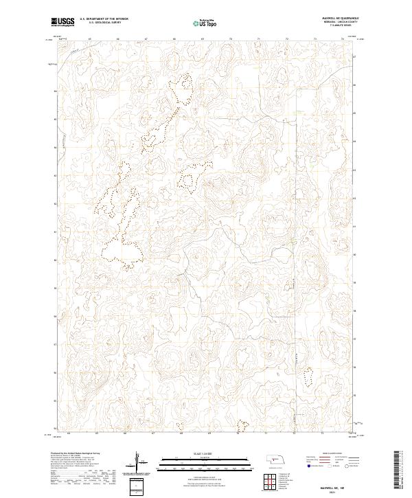
2021 Map of Maxwell NE
USGS Topo · Published 2021About this map
Sandhills terrain dominates this corner of Nebraska, where the landscape is defined by the undulating topography of the Platte River valley periphery. In the early 21st century, the area remains primarily open rangeland, marked by the sparse network of rural routes that skirt the edges of the hills. Travel through the region is anchored by the north-south passage along N Maxwell Rd and S Maxwell Rd, while Stewart Rd and E Rolling Hills Rd provide access into the higher elevations. The lack of concentrated settlements or industrial development on this quadrangle highlights the enduring rural character of Lincoln County, where the Public Land Survey System grid serves as the primary organizational structure for the vast, open acreage.
Find a feature on this map
10 named features on this map. Tap any name to fly to it.
Don’t see what you’re looking for? This feature index may not catch every label — zoom into the map to look around manually.
Map Details
Editions of this 2021 Maxwell NE Map
This is the sole edition of this map. No revisions or reprints were ever made.
Other maps of this area

1899 · North Platte
USGS Topo · 1:125,000

1902 · North Platte
USGS Topo · 1:125,000

1954 · North Platte
USGS Topo · 1:250,000

1956 · North Platte
USGS Topo · 1:250,000

1957 · North Platte
USGS Topo · 1:250,000

1967 · North Platte
USGS Topo · 1:250,000

1970 · North Platte East
USGS Topo · 1:24,000
1970 · Brady SW
USGS Topo · 1:24,000
1970 · Maxwell
USGS Topo · 1:24,000
1970 · Maxwell SW
USGS Topo · 1:24,000