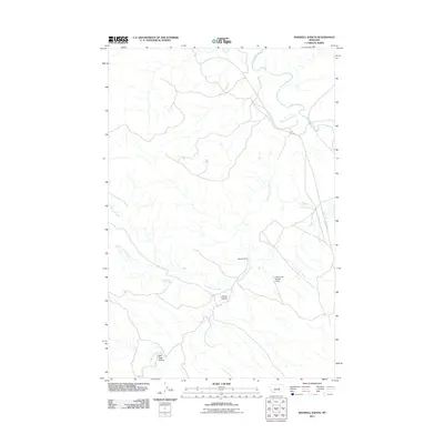
2011 Map of Maxwell Ranch
USGS Topo · Published 2011About this map
Maxwell Ranch sits as a central landmark in this Rosebud County landscape, where the seasonal hydrology of the Missouri River basin is clearly defined by numerous coulees and drainages. The Musselshell River winds through the northern portion of the quadrangle, joined by a network of tributaries including North Willow Creek and Mud Springs Creek. This terrain is deeply etched by Dutton Coulee and Salt Sage Coulee, illustrating the erosional patterns typical of this Montana ranching country. Local infrastructure is sparse, characterized primarily by the path of Melstone Rd and the H Stenisvad Number 2 Dam, which controls water flow in an area where moisture is a critical resource for the surrounding livestock operations and agricultural land.
Find a feature on this map
9 named features on this map. Tap any name to fly to it.
Don’t see what you’re looking for? This feature index may not catch every label — zoom into the map to look around manually.
Map Details
Editions of this 2011 Maxwell Ranch Map
This is the sole edition of this map. No revisions or reprints were ever made.
Other maps of this area

1954 · Forsyth
USGS Topo · 1:250,000

1954 · Roundup
USGS Topo · 1:250,000

1957 · Forsyth
USGS Topo · 1:250,000

1958 · Roundup
USGS Topo · 1:250,000

1958 · Forsyth
USGS Topo · 1:250,000

1962 · Mosby
USGS Topo · 1:24,000

1962 · Melstone NE
USGS Topo · 1:24,000

1962 · Maxwell Ranch
USGS Topo · 1:24,000

1962 · Melstone NW
USGS Topo · 1:24,000

1962 · Mosby SE
USGS Topo · 1:24,000