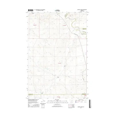
2017 Map of Maxwell Ranch
USGS Topo · Published 2017About this map
The Musselshell River meanders across this rural Montana landscape, defining the intersection of Garfield, Rosebud, Petroleum, and Musselshell counties. This territory is characterized by a complex network of seasonal drainage features including Circle Bar Coulee, Dutton Coulee, and Salt Sage Coulee. The presence of the Maxwell Ranch near the center of the sheet reflects the enduring ranching economy of the region, where wide-open spaces are managed through large private holdings. Navigation through this arid terrain is facilitated by several arterial routes, notably Melstone Rd and 59 Ranch Rd, which connect isolated homesteads to the wider county infrastructure. Water remains the primary geographical anchor, with Mud Springs Cr and N Willow Cr carving through the plains to meet the river.
Find a feature on this map
19 named features on this map. Tap any name to fly to it.
Don’t see what you’re looking for? This feature index may not catch every label — zoom into the map to look around manually.
Map Details
Editions of this 2017 Maxwell Ranch Map
This is the sole edition of this map. No revisions or reprints were ever made.
Other maps of this area

1954 · Forsyth
USGS Topo · 1:250,000

1954 · Roundup
USGS Topo · 1:250,000

1957 · Forsyth
USGS Topo · 1:250,000

1958 · Roundup
USGS Topo · 1:250,000

1958 · Forsyth
USGS Topo · 1:250,000

1962 · Mosby
USGS Topo · 1:24,000

1962 · Melstone NE
USGS Topo · 1:24,000

1962 · Maxwell Ranch
USGS Topo · 1:24,000

1962 · Melstone NW
USGS Topo · 1:24,000

1962 · Mosby SE
USGS Topo · 1:24,000