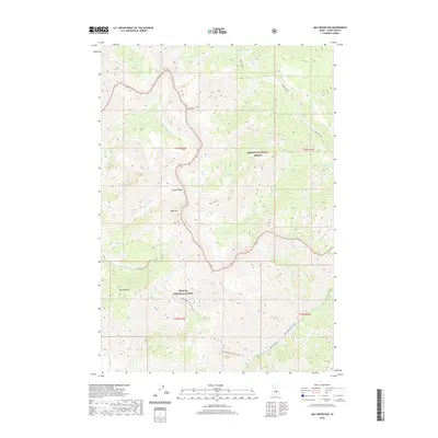
2020 Map of May Mountain
USGS Topo · Published 2020About this map
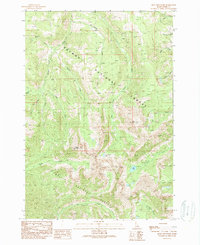
May Mtn and the high ridges of the Lemhi Range dominate this portion of Idaho's high country, marking the boundary between the Salmon National Forest and Challis National Forest. The landscape is defined by a dense network of drainage systems, including Hayden Creek flowing toward the north and Morgan Cr to the south. Historically significant for its rugged geography, the area shows very little human infrastructure beyond Morse Creek Rd, which follows the contours of the Morse Creek drainage. Notable peaks like Long Mtn provide essential landmarks for navigation within these national forest lands. Local history and genealogy researchers may find the specific naming of gulches and creeks, such as Spring Gulch and Bray Cr, useful for pinpointing early ranching or mining claims that often relied on these seasonal water sources for survival and commerce.
Find a feature on this map
29 named features on this map. Tap any name to fly to it.
Don’t see what you’re looking for? This feature index may not catch every label — zoom into the map to look around manually.
Map Details
Editions of this 2020 May Mountain Map
This is the sole edition of this map. No revisions or reprints were ever made.
Other maps of this area

1955 · Dubois
USGS Topo · 1:250,000

1956 · Patterson
USGS Topo · 1:62,500

1956 · May
USGS Topo · 1:62,500

1956 · Lemhi
USGS Topo · 1:62,500

1958 · Dubois
USGS Topo · 1:250,000
1962 · Allison Creek
USGS Topo · 1:24,000
1962 · Lem Peak
USGS Topo · 1:24,000

1980 · Leadore
USGS Topo · 1:100,000
1989 · May
USGS Topo · 1:24,000
1989 · Mogg Mountain
USGS Topo · 1:24,000