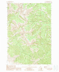
1989 Map of May Mountain
USGS Topo · Published 1989About this map
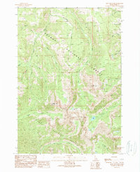
May Mountain and Long Mountain dominate this central Idaho landscape, serving as the boundary between two major federal wilderness management zones. The map illustrates the convergence of the Salmon National Forest and Challis National Forest, where a complex network of high-elevation drainages shapes the terrain. Elaborate water systems including Morgan Creek and its North Fork Morgan Creek carve through the western slopes, while the headwaters of Hayden Creek and its West Fork Hayden Creek define the eastern valleys. This late-twentieth-century survey captures the area as it appeared before many modern administrative adjustments, recording the precise locations of remote features like Spring Gulch and Tater Creek. The cartography emphasizes the intricate drainage patterns that have historically dictated access and resource management in this portion of Lemhi County.
Find a feature on this map
20 named features on this map. Tap any name to fly to it.
Don’t see what you’re looking for? This feature index may not catch every label — zoom into the map to look around manually.
Map Details
Editions of this 1989 May Mountain Map
This is the sole edition of this map. No revisions or reprints were ever made.
Other maps of this area

1955 · Dubois
USGS Topo · 1:250,000

1956 · Patterson
USGS Topo · 1:62,500

1956 · May
USGS Topo · 1:62,500

1956 · Lemhi
USGS Topo · 1:62,500

1958 · Dubois
USGS Topo · 1:250,000
1962 · Allison Creek
USGS Topo · 1:24,000
1962 · Lem Peak
USGS Topo · 1:24,000

1980 · Leadore
USGS Topo · 1:100,000
1989 · May
USGS Topo · 1:24,000
1989 · Mogg Mountain
USGS Topo · 1:24,000