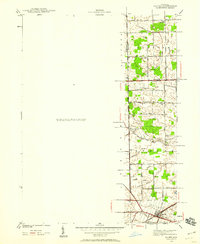
1940 Map of Maybee
USGS Topo · Published 1940About this map
The village of Maybee anchors the southern portion of this landscape at the intersection of the Detroit Toledo and Ironton railroad and several regional thoroughfares. Surveyed just before the United States entered World War II, the area displays a transition from the agricultural plains of Exeter and Sumpter townships to a more structured network of roads and drainage channels. Local infrastructure is defined by a dense system of managed waterways, including the Bradshaw Drain and Clark Morey Drain, which were essential for maintaining the productivity of the surrounding farmland.
Find a feature on this map
57 named features on this map. Tap any name to fly to it.
Don’t see what you’re looking for? This feature index may not catch every label — zoom into the map to look around manually.
Map Details
Editions of this 1940 Maybee Map
This is the sole edition of this map. No revisions or reprints were ever made.
Other maps of this area

1902 · Ypsilanti
USGS Topo · 1:62,500

1904 · Ann Arbor
USGS Topo · 1:125,000

1906 · Ypsilanti
USGS Topo · 1:62,500

1906 · Romulus
USGS Topo · 1:62,500

1908 · Ann Arbor
USGS Topo · 1:125,000

1912 · Monroe
USGS Topo · 1:62,500

1912 · Dundee
USGS Topo · 1:62,500

1914 · Monroe
USGS Topo · 1:62,500

1926 · Dundee
USGS Topo · 1:62,500

1927 · Monroe
USGS Topo · 1:31,680
Featured Places
- Sumpter Township, MI
- Augusta Charter Township, MI
- Exeter Township, MI
- London, London Township
- London Township, MI