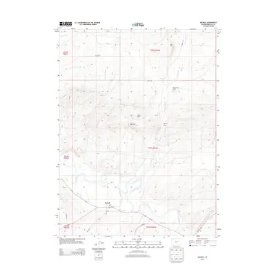
2013 Map of Maybell
USGS Topo · Published 2013About this map
Maybell stands as a focal point in this high-desert landscape of Moffat County, situated where Us-40 meets the vital waters of the Yampa River. The town's local infrastructure is clearly defined, from the Post Office and central streets like Lowell St to the historic Fairview Cemetery north of town. The surrounding terrain is shaped by an intricate network of irrigation and natural drainage, including the Maybell Ditch and numerous seasonal waterways like Deception Creek and Lay Creek. To the north, the topography rises toward Eagle Rock and the grazing lands of Eagle Park, while named water sources such as Olmstead Spring and Barber Spring indicate the importance of water management in this arid cattle-country environment. The map provides a detailed view of the section lines and township boundaries that define the rural property structure of northwestern Colorado.
Find a feature on this map
30 named features on this map. Tap any name to fly to it.
Don’t see what you’re looking for? This feature index may not catch every label — zoom into the map to look around manually.
Map Details
Editions of this 2013 Maybell Map
This is the sole edition of this map. No revisions or reprints were ever made.
Other maps of this area

1907 · White River
USGS Topo · 1:125,000

1910 · Danforth Hills
USGS Topo · 1:125,000

1910 · White River
USGS Topo · 1:125,000

1912 · Axial
USGS Topo · 1:62,500

1914 · Axial
USGS Topo · 1:62,500

1916 · Craig
USGS Topo · 1:125,000

1954 · Vernal
USGS Topo · 1:250,000

1954 · Craig
USGS Topo · 1:250,000

1957 · Craig
USGS Topo · 1:250,000

1958 · Vernal
USGS Topo · 1:250,000