2022 Map of Maybell
USGS Topo · Published 2022About this map
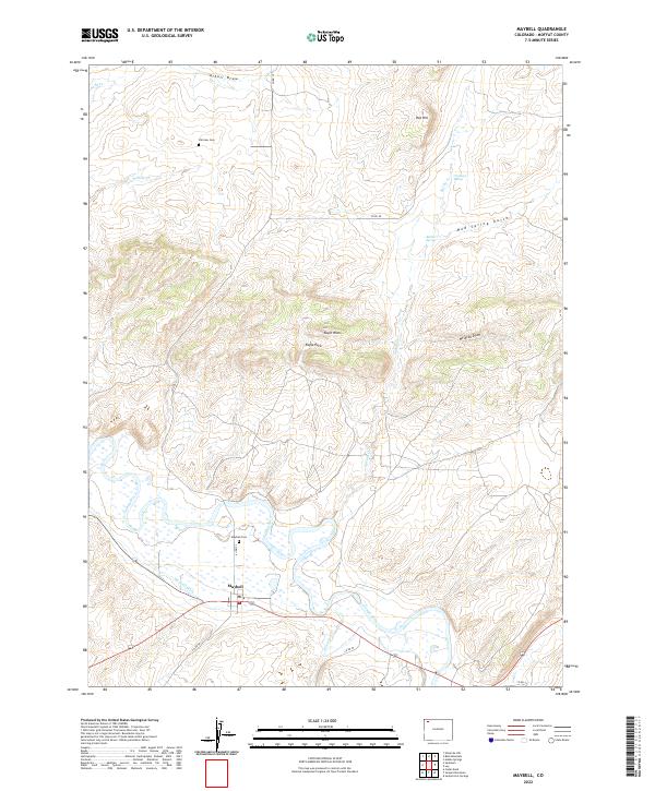
The Yampa River valley serves as the central lifeline for this Moffat County landscape, where the small settlement of Maybell is established near the irrigation works of the Maybell Ditch. This 2022 survey documents a ranching and rural residential environment defined by significant drainage systems and spring-fed features. Local genealogy is anchored by the Maybell Cem just north of the townsite and the Fairview Cem located further north near Willow Cr. The topography transitions from the river bottom to prominent high points like Eagle Rock and Hat Hill, with numerous named draws and gulches including Wildcat Draw and Mud Spring Gulch cutting through the terrain. The presence of Omstead Spring and Barber Spring highlights the importance of water sources in this arid part of western Colorado.
Find a feature on this map
30 named features on this map. Tap any name to fly to it.
Don’t see what you’re looking for? This feature index may not catch every label — zoom into the map to look around manually.
Map Details
Editions of this 2022 Maybell Map
This is the sole edition of this map. No revisions or reprints were ever made.