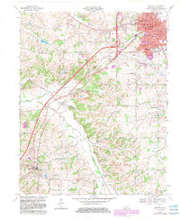
1969 Map of Mayfield
USGS Topo · Published 1983About this map
Mayfield serves as the bustling Graves County seat in this detailed 1960s survey, characterized by its dense grid of streets, civic landmarks like the Courthouse, and the industrial presence of the Woolen Mill. The Illinois Central Railroad and the Purchase Parkway intersect the landscape, highlighting the area's role as a regional transit hub. Beyond the city center, the terrain shifts into the rural communities of Pryorsburg and Wingo, where life centers around country institutions such as St James Ch and Bethel Cem.
Find a feature on this map
79 named features on this map. Tap any name to fly to it.
Don’t see what you’re looking for? This feature index may not catch every label — zoom into the map to look around manually.
Map Details
Editions of this 1969 Mayfield Map
2 editions found
Other maps of this area

1936 · Farmington
USGS Topo · 1:24,000

1936 · Westplains
USGS Topo · 1:24,000

1951 · Farmington
USGS Topo · 1:24,000

1951 · Hickory
USGS Topo · 1:24,000
1951 · Westplains
USGS Topo · 1:24,000

1951 · Hickory
USGS Topo · 1:62,500

1952 · Mayfield
USGS Topo · 1:24,000

1952 · Dublin
USGS Topo · 1:24,000

1952 · Cuba
USGS Topo · 1:24,000

1952 · Fancy Farm
USGS Topo · 1:24,000