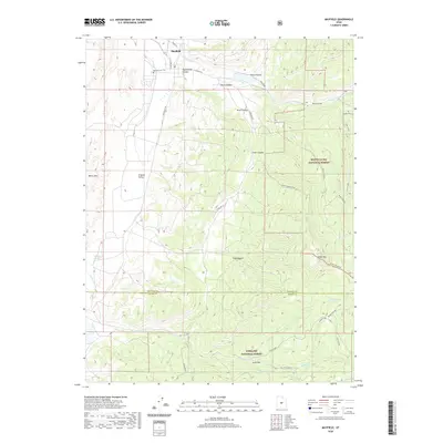
2020 Map of Mayfield
USGS Topo · Published 2020About this map
Mayfield stands at the mouth of Twelvemile Canyon, where the high plateaus of central Utah descend into the Arapien Valley. This 2020 edition reveals the intersection of public lands and local agriculture, with the town's grid positioned just west of the Manti-La Sal National Forest boundary. Genealogical interest centers on the Mayfield Cem located along Southfield Rd, while the surrounding terrain is defined by deep drainage systems like South Hollow and Order Canyon. The southern portion of the map transitions into the Fishlake National Forest near Jacks Flat, reflecting the region's complex forest management and rugged geography. Water resources are critical in this landscape, with Twelvemile Cr and Willow Cr providing the primary drainage for the high country, supporting remote spots like Balsam Grove and Michaelson Springs.
Find a feature on this map
35 named features on this map. Tap any name to fly to it.
Don’t see what you’re looking for? This feature index may not catch every label — zoom into the map to look around manually.
Map Details
Editions of this 2020 Mayfield Map
This is the sole edition of this map. No revisions or reprints were ever made.
Other maps of this area

1885 · Manti
USGS Topo · 1:250,000

1885 · Fish Lake
USGS Topo · 1:250,000

1895 · Manti
USGS Topo · 1:250,000

1896 · Fish Lake
USGS Topo · 1:250,000

1956 · Salina
USGS Topo · 1:250,000

1956 · Price
USGS Topo · 1:250,000

1960 · Price
USGS Topo · 1:250,000

1960 · Salina
USGS Topo · 1:250,000

1962 · Salina
USGS Topo · 1:250,000

1962 · Price
USGS Topo · 1:250,000