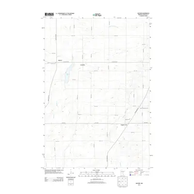
2013 Map of Mayhew
USGS Topo · Published 2013About this map
Mayhew Lake sits at the heart of this landscape in Saint George Township, anchoring a region of agricultural fields and watercourses. Small settlements like Mayhew and Fruitville are connected by a grid of rural roads, including Mayhew Lake Rd Ne, while Popple Creek lies to the south near the banks of the Elk River. The map reveals several religious and community landmarks, such as Saint Marys Cem, Saint John's Cem, and the Polish Lutheran Church Cem, which serve as vital points for genealogical research in this part of Benton County. Drainage and irrigation patterns are clearly marked by features like County Ditch Number Seven, Mayhew Cr, and Sucker Cr, illustrating the managed nature of the local terrain.
Find a feature on this map
34 named features on this map. Tap any name to fly to it.
Don’t see what you’re looking for? This feature index may not catch every label — zoom into the map to look around manually.
Map Details
Editions of this 2013 Mayhew Map
This is the sole edition of this map. No revisions or reprints were ever made.
Other maps of this area

1948 · Pierz
USGS Topo · 1:62,500

1950 · Pierz
USGS Topo · 1:62,500

1950 · St. Cloud
USGS Topo · 1:62,500

1953 · Saint Cloud
USGS Topo · 1:250,000

1953 · Stillwater
USGS Topo · 1:250,000

1955 · Stillwater
USGS Topo · 1:250,000

1957 · Saint Cloud
USGS Topo · 1:250,000

1958 · Stillwater
USGS Topo · 1:250,000

1958 · Saint Cloud
USGS Topo · 1:250,000

1965 · Stillwater
USGS Topo · 1:250,000
Featured Places
- Saint George Township, MN
- Gilmanton Township, MN
- Fruitville, MN
- Popple Creek, MN
- Mayhew Lake Township, MN