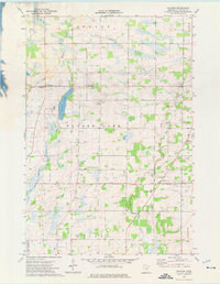
1974 Map of Mayhew
USGS Topo · Published 1976About this map
Mayhew Lake and its surrounding agricultural townships define this central Minnesota landscape in the mid-1970s. The region is characterized by a dense network of water management features like County Ditch No 1 and County Ditch No 10, which support the rural farmsteads of Mayhew Lake, Graham, and Minden townships. Small settlements like Mayhew and Popple Creek serve as local anchors, with St Marys Cem and St Johns Ch providing important genealogical reference points for families of the area.
Find a feature on this map
21 named features on this map. Tap any name to fly to it.
Don’t see what you’re looking for? This feature index may not catch every label — zoom into the map to look around manually.
Map Details
Editions of this 1974 Mayhew Map
This is the sole edition of this map. No revisions or reprints were ever made.
Other maps of this area

1948 · Pierz
USGS Topo · 1:62,500

1950 · Pierz
USGS Topo · 1:62,500

1950 · St. Cloud
USGS Topo · 1:62,500

1953 · Saint Cloud
USGS Topo · 1:250,000

1953 · Stillwater
USGS Topo · 1:250,000

1955 · Stillwater
USGS Topo · 1:250,000

1957 · Saint Cloud
USGS Topo · 1:250,000

1958 · Stillwater
USGS Topo · 1:250,000

1958 · Saint Cloud
USGS Topo · 1:250,000

1965 · Stillwater
USGS Topo · 1:250,000
Featured Places
- Saint George Township, MN
- Alberta Township, MN
- Mayhew Lake Township, MN
- Graham Township, MN
- Minden Township, MN