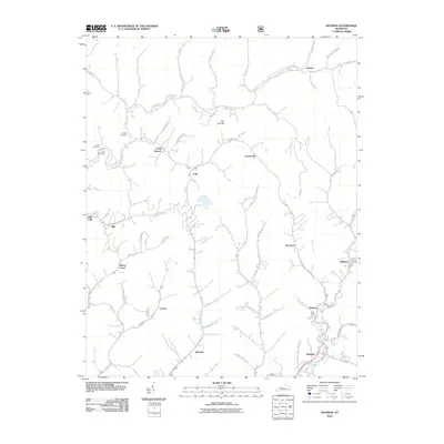
2010 Map of Mayking
USGS Topo · Published 2010About this map
Rockhouse Creek and its many winding tributaries define this portion of the Kentucky mountains, where small communities follow the narrow valley floors. Family history is well-preserved through several small burial grounds, including Collins Cemetery, Cook Cemetery, and Ison Cemetery, which sit overlooking the settlements of Camp Branch and Little Colly. The map reveals a dense network of mountain roads and hollows, such as Washboard Rd and Loggy Hollow, that connect coal-country hamlets like Deane, Thornton, and Mayking. The landscape is a complex system of drainage branches, from the Hurricane Branch to the Wolfpen Branch, illustrating the traditional Appalachian settlement pattern where homes and infrastructure are tightly clustered along the watercourses of the North Fork Kentucky River watershed.
Find a feature on this map
52 named features on this map. Tap any name to fly to it.
Don’t see what you’re looking for? This feature index may not catch every label — zoom into the map to look around manually.
Map Details
Editions of this 2010 Mayking Map
This is the sole edition of this map. No revisions or reprints were ever made.
Other maps of this area

1890 · Whitesburg
USGS Topo · 1:125,000

1892 · Whitesburg
USGS Topo · 1:125,000

1912 · Pound
USGS Topo · 1:48,000

1912 · Hindman
USGS Topo · 1:48,000

1913 · Oven Fork
USGS Topo · 1:48,000

1914 · Pound
USGS Topo · 1:62,500

1914 · Vergie
USGS Topo · 1:48,000

1915 · Hindman
USGS Topo · 1:62,500

1915 · Whitesburg
USGS Topo · 1:62,500

1916 · Pikeville
USGS Topo · 1:62,500