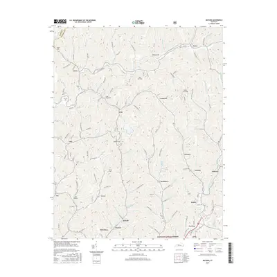
2016 Map of Mayking
USGS Topo · Published 2016About this map
Whitesburg and Mayking anchor this portion of Letcher County, where the North Fork Kentucky River cuts through the steep eastern Kentucky topography. The map illustrates a dense network of hollow-based settlements and family sites typical of the region's historical development patterns, including Colson, Thornton, and Sergent. Genealogists may find particular value in the several documented family burial grounds, such as Collins Cem, Cook Cem, and Ison Cem, situated near the headwaters of Rockhouse Creek. In the southern portion of the sheet, the Jefferson National Forest begins its presence, bordering communities like Marlowe and Bellcraft. The terrain is punctuated by significant gaps that historically dictated travel and commerce, including Sandlick Gap and Indian Creek Gap, connecting the various branches and forks that define this landscape.
Find a feature on this map
126 named features on this map. Tap any name to fly to it.
Don’t see what you’re looking for? This feature index may not catch every label — zoom into the map to look around manually.
Map Details
Editions of this 2016 Mayking Map
This is the sole edition of this map. No revisions or reprints were ever made.
Other maps of this area

1890 · Whitesburg
USGS Topo · 1:125,000

1892 · Whitesburg
USGS Topo · 1:125,000

1912 · Pound
USGS Topo · 1:48,000

1912 · Hindman
USGS Topo · 1:48,000

1913 · Oven Fork
USGS Topo · 1:48,000

1914 · Pound
USGS Topo · 1:62,500

1914 · Vergie
USGS Topo · 1:48,000

1915 · Hindman
USGS Topo · 1:62,500

1915 · Whitesburg
USGS Topo · 1:62,500

1916 · Pikeville
USGS Topo · 1:62,500