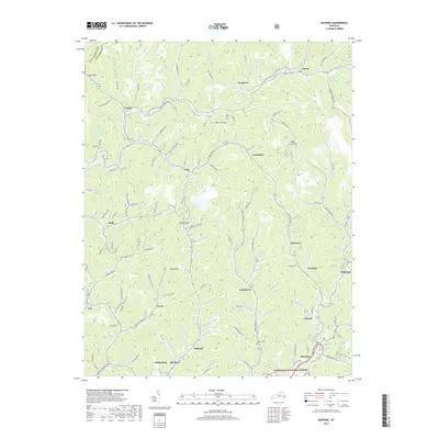
2019 Map of Mayking
USGS Topo · Published 2019About this map
Whitesburg and Mayking anchor this portion of Letcher County, where the terrain is defined by a dense network of mountain gaps and winding creeks. The landscape is a complex web of narrow valleys, where settlements like Colson, Thornton, and Millstone follow the natural paths carved by Rockhouse Cr and Thornton Cr. The area is characterized by numerous small family and community burial grounds, including Collins Cem, Ison Cem, and Adams Cem, which provide essential points of reference for genealogical research. Higher elevations are marked by notable passages such as Logan Gap, Indian Creek Gap, and Sandlick Gap. To the south, the map reaches into the protected boundaries of the Jefferson National Forest. This topographical study reveals the historic settlement patterns of the Kentucky coalfields, where roads such as Consol Tipple Rd and Mayking Loop connect dispersed mountain communities.
Find a feature on this map
149 named features on this map. Tap any name to fly to it.
Don’t see what you’re looking for? This feature index may not catch every label — zoom into the map to look around manually.
Map Details
Editions of this 2019 Mayking Map
This is the sole edition of this map. No revisions or reprints were ever made.
Other maps of this area

1890 · Whitesburg
USGS Topo · 1:125,000

1892 · Whitesburg
USGS Topo · 1:125,000

1912 · Pound
USGS Topo · 1:48,000

1912 · Hindman
USGS Topo · 1:48,000

1913 · Oven Fork
USGS Topo · 1:48,000

1914 · Pound
USGS Topo · 1:62,500

1914 · Vergie
USGS Topo · 1:48,000

1915 · Hindman
USGS Topo · 1:62,500

1915 · Whitesburg
USGS Topo · 1:62,500

1916 · Pikeville
USGS Topo · 1:62,500