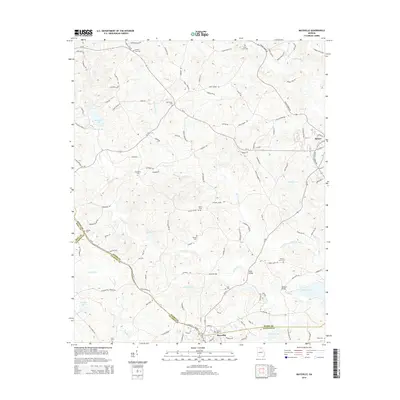
2014 Map of Maysville
USGS Topo · Published 2014About this map
The town of Maysville sits along the southern border of this North Georgia survey, where the boundaries of Banks, Jackson, and Hall counties converge. The landscape is defined by the winding course of Grove Cr and its tributary, Hickory Level Cr, which together shape the region's undulating topography. Rural life and local heritage are anchored by numerous community landmarks, including historical crossings such as Savill Bridge, Ryles Bridge, and Mangum Bridge.
Find a feature on this map
119 named features on this map. Tap any name to fly to it.
Don’t see what you’re looking for? This feature index may not catch every label — zoom into the map to look around manually.
Map Details
Editions of this 2014 Maysville Map
This is the sole edition of this map. No revisions or reprints were ever made.
Other maps of this area

1891 · Gainesville
USGS Topo · 1:125,000

1891 · Carnesville
USGS Topo · 1:125,000

1954 · Greenville
USGS Topo · 1:250,000

1958 · Greenville
USGS Topo · 1:250,000

1964 · Commerce
USGS Topo · 1:24,000

1964 · Maysville
USGS Topo · 1:24,000

1964 · Lula
USGS Topo · 1:24,000
1964 · Lake Russell
USGS Topo · 1:24,000

1964 · Pendergrass
USGS Topo · 1:24,000
1964 · Baldwin
USGS Topo · 1:24,000