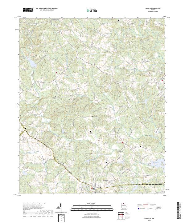
2024 Map of Maysville
USGS Topo · Published 2024About this map
The town of Maysville straddles the border of Banks and Jackson counties, serving as a focal point for this north Georgia landscape. To the northeast, the community of Homer sits near the headwaters of the Hudson River. The region is defined by a dense network of water management and local cemeteries that reflect generations of rural settlement. Numerous small impoundments like Reservoir 21, Reservoir 25, and Reservoir 51 are scattered across the terrain, interrupting the flow of Grove Creek and its tributaries. For those researching local lineages, the map identifies several family-named burial sites such as Veal Cem, Ellison Cem, and Martin Cem. The road network, including W Ridgeway Rd and Lula Rd, connects these residential pockets and historic landmarks like Grove Level Baptist Cem and Sunrise Cem near the town centers.
Find a feature on this map
131 named features on this map. Tap any name to fly to it.
Don’t see what you’re looking for? This feature index may not catch every label — zoom into the map to look around manually.
Map Details
Editions of this 2024 Maysville Map
This is the sole edition of this map. No revisions or reprints were ever made.
Other maps of this area

1891 · Gainesville
USGS Topo · 1:125,000

1891 · Carnesville
USGS Topo · 1:125,000

1954 · Greenville
USGS Topo · 1:250,000

1958 · Greenville
USGS Topo · 1:250,000

1964 · Commerce
USGS Topo · 1:24,000

1964 · Maysville
USGS Topo · 1:24,000

1964 · Lula
USGS Topo · 1:24,000
1964 · Lake Russell
USGS Topo · 1:24,000

1964 · Pendergrass
USGS Topo · 1:24,000
1964 · Baldwin
USGS Topo · 1:24,000