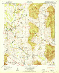
1951 Map of Maysville
USGS Topo · Published 1951About this map
The Flint River defines the agrarian and industrial geography of Madison County on this mid-century survey, winding through a landscape of family-named settlements and early milling sites. Significant industrial landmarks like Bell Factory and McCaleb Mill at Three Forks point to the river-driven economy of previous generations, while the crossing at Bloucher Ford highlights the historic transit patterns of the valley. To the east, the terrain rises sharply into the ridgelines of Berry Mountain and Nance Mountain, sheltering distinct agricultural pockets such as Sharp Cove and Killingsworth Cove.
Find a feature on this map
77 named features on this map. Tap any name to fly to it.
Don’t see what you’re looking for? This feature index may not catch every label — zoom into the map to look around manually.
Map Details
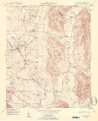
Editions of this 1951 Maysville Map
2 editions found
Other maps of this area

1888 · Scottsboro
USGS Topo · 1:125,000

1888 · Huntsville
USGS Topo · 1:125,000

1892 · Huntsville
USGS Topo · 1:125,000

1892 · Scottsboro
USGS Topo · 1:125,000

1936 · King Cove
USGS Topo · 1:24,000

1936 · Meridianville
USGS Topo · 1:24,000

1936 · Moontown
USGS Topo · 1:24,000

1936 · Fisk
USGS Topo · 1:24,000

1936 · Hollytree
USGS Topo · 1:24,000

1936 · Maysville
USGS Topo · 1:24,000