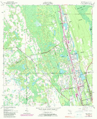
1950 Map of Maytown
USGS Topo · Published 1981About this map
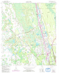
Large Spanish land grants such as the John H McIntosh Grant and Joseph Wales Grant dominate the landscape of the Volusia and Brevard county line in the mid-20th century. This area is characterized by a complex network of wetlands and hammock terrain, notably Turnbull Hummock, where the transition from wild marshland to early coastal development is evident. The settlement of Maytown sits at a junction where an Old Railroad Grade suggests a history of timber or citrus transport that preceded the modern road system.
Find a feature on this map
14 named features on this map. Tap any name to fly to it.
Don’t see what you’re looking for? This feature index may not catch every label — zoom into the map to look around manually.
Map Details
Editions of this 1950 Maytown Map
6 editions found
Other maps of this area

1949 · Oak Hill
USGS Topo · 1:24,000

1949 · Mims
USGS Topo · 1:24,000

1949 · Osceola
USGS Topo · 1:24,000

1950 · Maytown
USGS Topo · 1:24,000

1950 · Ariel
USGS Topo · 1:24,000

1950 · Edgewater
USGS Topo · 1:24,000

1950 · Aurantia
USGS Topo · 1:24,000

1952 · Mims
USGS Topo · 1:24,000

1953 · Geneva
USGS Topo · 1:24,000

1955 · Orlando
USGS Topo · 1:250,000