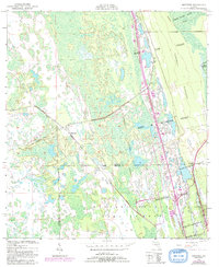
1950 Map of Maytown
USGS Topo · Published 1992About this map
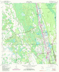
Large Spanish land grants and a network of decommissioned transit lines dominate this coastal Florida landscape at the mid-century mark. The tiny settlement of Maytown sits at a historic junction where the Old Railroad Grade meets tracks marked Abandoned, reflecting a shifting timber or citrus economy. To the east, the map reveals the legacy of colonial-era property boundaries, with clearly defined tracts like the Joseph Wales Grant, Delespine Grant, and William Garvin Grant preserving the region's historical land-tenure patterns.
Find a feature on this map
19 named features on this map. Tap any name to fly to it.
Don’t see what you’re looking for? This feature index may not catch every label — zoom into the map to look around manually.
Map Details
Editions of this 1950 Maytown Map
6 editions found
Other maps of this area

1949 · Oak Hill
USGS Topo · 1:24,000

1949 · Mims
USGS Topo · 1:24,000

1949 · Osceola
USGS Topo · 1:24,000

1950 · Maytown
USGS Topo · 1:24,000

1950 · Ariel
USGS Topo · 1:24,000

1950 · Edgewater
USGS Topo · 1:24,000

1950 · Aurantia
USGS Topo · 1:24,000

1952 · Mims
USGS Topo · 1:24,000

1953 · Geneva
USGS Topo · 1:24,000

1955 · Orlando
USGS Topo · 1:250,000