
1949 Map of Mayview
USGS Topo · Published 1956About this map
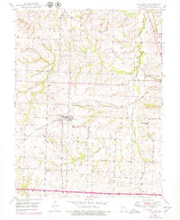
The community of Mayview serves as the central hub for this late-1940s landscape, where the Gulf Mobile and Ohio railroad cuts through the terrain. Evidence of the local economy is scattered across the township, including several Strip Mines and a prominent Mine Dump just outside the town limits. The settlement pattern is defined by a high density of rural schoolhouses, such as Maple Glen Sch, Prairie Sch, and Wheatly Sch, each serving localized farm clusters. Further south, the crossroads of Fortyville and the Marvin Chapel church anchor the rural community. Drainage across the region is primarily managed by the winding paths of Tabo Creek and Brush Creek, which flow through the undulating agricultural land between Lexington and Washington townships.
Find a feature on this map
22 named features on this map. Tap any name to fly to it.
Don’t see what you’re looking for? This feature index may not catch every label — zoom into the map to look around manually.
Map Details
Editions of this 1949 Mayview Map
2 editions found
Other maps of this area

1885 · Warrensburg
USGS Topo · 1:125,000

1887 · Warrensburg
USGS Topo · 1:125,000

1889 · Lexington
USGS Topo · 1:125,000

1894 · Warrensburg
USGS Topo · 1:125,000

1917 · Knobnoster
USGS Topo · 1:62,500

1947 · Jefferson City
USGS Topo · 1:250,000

1949 · Lexington East
USGS Topo · 1:24,000

1949 · Lexington West
USGS Topo · 1:24,000

1949 · Odessa North
USGS Topo · 1:24,000

1950 · Lexington East
USGS Topo · 1:24,000