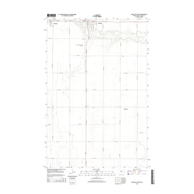
2014 Map of Mayville South
USGS Topo · Published 2014About this map
The Goose River meanders through the fertile Red River Valley landscape, linking the neighboring communities of Portland and Mayville in Traill County. This 2014 survey documents the established grid of these agricultural hubs, where residential streets like Main St W and 3rd St SE transition into the surrounding farm country. The map highlights the critical role of water management in this flat terrain, tracing the paths of the Mayville Drain Number 19 and Hanson Drain. South of the primary settlements, the small community of Murray sits along the section lines, reflecting the rural settlement patterns typical of eastern North Dakota. Transportation infrastructure is well-defined, ranging from the localized operations at the Mayville Municipal Airport to the extensive network of numbered county avenues and streets that facilitate the region's agricultural economy.
Find a feature on this map
41 named features on this map. Tap any name to fly to it.
Don’t see what you’re looking for? This feature index may not catch every label — zoom into the map to look around manually.
Map Details
Editions of this 2014 Mayville South Map
This is the sole edition of this map. No revisions or reprints were ever made.
Other maps of this area

1918 · Kelso
USGS Topo · 1:62,500

1943 · Kelso
USGS Topo · 1:62,500

1952 · Grand Forks
USGS Topo · 1:250,000

1956 · Grand Forks
USGS Topo · 1:250,000

1966 · Grand Forks
USGS Topo · 1:250,000

1966 · Galesburg
USGS Topo · 1:24,000

1967 · Mayville South
USGS Topo · 1:24,000

1967 · Blanchard
USGS Topo · 1:24,000
1967 · Hillsboro NW
USGS Topo · 1:24,000
1968 · Galesburg
USGS Topo · 1:24,000