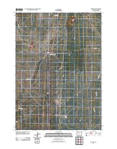
2011 Map of Mazama
USGS Topo · Published 2011About this map
Mazama and its surrounding ranching and transport infrastructure anchor this high-altitude landscape in Klamath County. The layout emphasizes the critical intersections of the region, specifically Mazama Junction and Diamond Lake Junction, which facilitate movement across this relatively open terrain. Notable landforms such as Diamond Crater, Buckeye Butte, and Rock Point provide distinct landmarks for navigation.
Find a feature on this map
15 named features on this map. Tap any name to fly to it.
Don’t see what you’re looking for? This feature index may not catch every label — zoom into the map to look around manually.
Map Details
Editions of this 2011 Mazama Map
This is the sole edition of this map. No revisions or reprints were ever made.
Other maps of this area

1889 · Klamath
USGS Topo · 1:250,000

1894 · Klamath
USGS Topo · 1:250,000

1935 · Chemult
USGS Topo · 1:96,000

1941 · Chemult
USGS Topo · 1:125,000

1955 · Crescent
USGS Topo · 1:250,000

1955 · Klamath Falls
USGS Topo · 1:250,000

1957 · Crescent
USGS Topo · 1:250,000

1957 · Klamath Marsh
USGS Topo · 1:62,500

1957 · Lenz
USGS Topo · 1:62,500

1958 · Crescent
USGS Topo · 1:250,000