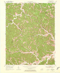
1953 Map of Mazie
USGS Topo · Published 1972About this map
Gas And Oil Field operations define the local economy across this section of Lawrence and Elliott Counties in the early 1950s. The landscape is deeply incised by the Little Sandy River and its numerous tributaries, including Hurricane Creek and Whites Creek. Small rural communities such as Mazie and Martha serve as local anchors, while the terrain is dotted with family-named landmarks like the Jason Boggs Cemetery and Hay Cemetery. The infrastructure of the era is evident in the network of one-room schoolhouses, including Upper Cains Creek School and Boggs School, which were essential to these isolated hollows. Industrial activity is visible in the north with strip mines appearing near Hamilton, contrasting with the more traditional subsistence landscape found along the Left Fork and Right Fork of the local creek systems.
Find a feature on this map
71 named features on this map. Tap any name to fly to it.
Don’t see what you’re looking for? This feature index may not catch every label — zoom into the map to look around manually.
Map Details
Editions of this 1953 Mazie Map
3 editions found
Other maps of this area

1886 · Prestonsburg
USGS Topo · 1:125,000

1889 · Salyersville
USGS Topo · 1:125,000

1891 · Salyersville
USGS Topo · 1:125,000

1892 · Prestonsburg
USGS Topo · 1:125,000

1899 · Salyersville
USGS Topo · 1:125,000

1903 · Kenova
USGS Topo · 1:125,000

1904 · Kenova
USGS Topo · 1:125,000

1915 · Paintsville
USGS Topo · 1:48,000

1917 · Paintsville
USGS Topo · 1:62,500

1950 · Bruin
USGS Topo · 1:24,000