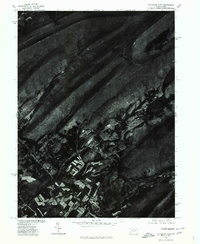
1977 Map of Mc Alevys Fort
USGS Topo · Published 1979About this map
Mc Alevys Fort sits at the heart of this 1977 aerial survey, showing the late-twentieth-century landscape of northern Huntingdon County. The orthophoto map reveals the intricate patterns of agricultural fields and farmsteads concentrated along the valley of Standing Stone Creek. This drainage corridor serves as the primary artery for settlement, carved between the prominent ridges of Tussey Mountain and Greenlee Ridge. The imagery provides a clear view of the contrast between the cleared valley floors and the densely forested slopes of Broad Mountain and Forkhead Mountain. Produced in cooperation with the Soil Conservation Service, the map emphasizes the relationship between land use and the region's folded mountain topography, preserving the exact footprint of the community and its surrounding woodlots during the late 1970s.
Find a feature on this map
6 named features on this map. Tap any name to fly to it.
Don’t see what you’re looking for? This feature index may not catch every label — zoom into the map to look around manually.
Map Details
Editions of this 1977 Mc Alevys Fort Map
This is the sole edition of this map. No revisions or reprints were ever made.
Other maps of this area

1908 · Bellefonte
USGS Topo · 1:62,500

1909 · Bellefonte
USGS Topo · 1:62,500

1919 · Menno
USGS Topo · 1:62,500

1924 · Centre Hall
USGS Topo · 1:62,500

1924 · Lewistown
USGS Topo · 1:62,500

1927 · Lewisburg
USGS Topo · 1:62,500

1929 · Centre Hall
USGS Topo · 1:62,500

1935 · Allensville
USGS Topo · 1:62,500

1938 · Allensville
USGS Topo · 1:62,500

1943 · Lewistown
USGS Topo · 1:125,000
Featured Places
- Jackson Township, PA
- Harris Township, PA
- McAlevys Fort, Jackson Township
- Ferguson Township, PA
- Barree Township, PA