
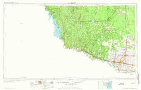
1957 Map of Mc Allen
USGS Topo · Published 1962About this map
The Rio Grande valley at the dawn of the 1960s reveals a landscape defined by shifting borders and industrial growth. Along the river, a chain of settlements including Rio Grande City, Mission, and McAllen follows the path of the Missouri Pacific railroad, reflecting the agricultural and transit importance of the corridor. To the west, the recently formed Falcon Reservoir has reshaped the terrain near Falcon Heights and Zapata, while the interior is densely marked with oil and gas wells, particularly around the Colorado Oil Field.
Find a feature on this map
95 named features on this map. Tap any name to fly to it.
Don’t see what you’re looking for? This feature index may not catch every label — zoom into the map to look around manually.
Map Details
Editions of this 1957 Mc Allen Map
2 editions found
Other maps of this area

1914 · San Juan
USGS Topo · 1:48,000

1916 · San Juan
USGS Topo · 1:62,500

1921 · Falfurrias
USGS Topo · 1:125,000

1922 · La Sal Vieja
USGS Topo · 1:62,500

1923 · Armstrong
USGS Topo · 1:62,500

1928 · Sarita
USGS Topo · 1:125,000

1938 · Falcon
USGS Topo · 1:62,500

1938 · El Sauz
USGS Topo · 1:62,500

1938 · Agua Nueva
USGS Topo · 1:62,500

1938 · Sal Colorada
USGS Topo · 1:62,500