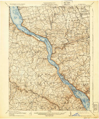
1912 Map of Mc Calls Ferry
USGS Topo · Published 1930About this map
The Susquehanna River carves a deep path through this landscape, defining the boundary between Lancaster Co and York Co. Along its banks, the river-and-rail economy of the early twentieth century is visible in crossings like Shenks Ferry and the Columbia and Port Deposit Branch line. Industrial and agricultural hubs like Safe Harbor, Martic Forge, and York Furnace dot the rugged creek valleys that feed into the main waterway. Local genealogy is well-represented through numerous rural institutions, including Bethel Church, Erbs Mill, and a high density of country schoolhouses such as Mylin School and Hake School. The map reveals a transition from the larger riverfront settlements like Washingtonboro to the upland farming communities of Willow Street and Marticville, connected by the winding routes of the Pennsylvania RR.
Find a feature on this map
144 named features on this map. Tap any name to fly to it.
Don’t see what you’re looking for? This feature index may not catch every label — zoom into the map to look around manually.
Map Details
Editions of this 1912 Mc Calls Ferry Map
5 editions found

Other maps of this area

1900 · Havre De Grace
USGS Topo · 1:62,500

1900 · Parkton
USGS Topo · 1:62,500

1901 · Belair
USGS Topo · 1:62,500

1902 · Parkton
USGS Topo · 1:62,500

1902 · Lancaster
USGS Topo · 1:62,500

1904 · Lancaster
USGS Topo · 1:62,500

1906 · New Holland
USGS Topo · 1:62,500

1908 · Middletown
USGS Topo · 1:62,500

1908 · New Holland
USGS Topo · 1:62,500

1908 · York
USGS Topo · 1:62,500
Featured Places
- West Lampeter Township, PA
- Willow Street, West Lampeter Township
- Millersville, PA
- Pequea, Conestoga Township
- Conestoga Township, PA