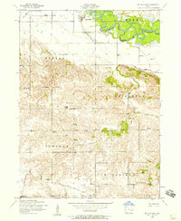
1953 Map of Mc Causland
USGS Topo · Published 1957About this map
The Wapsipinicon River meanders across the northern portion of this landscape, forming the boundary between Clinton and Scott counties. Centered on the town of McCausland, the area is defined by its mid-century agricultural character, where a dense network of country schoolhouses like Wapsie View School, Locust Lane School, and Maple Glenn School once served the rural community. The presence of a dismantled railroad north of McCausland indicates a shifting transportation landscape as the mid-1950s approached.
Find a feature on this map
34 named features on this map. Tap any name to fly to it.
Don’t see what you’re looking for? This feature index may not catch every label — zoom into the map to look around manually.
Map Details
Editions of this 1953 Mc Causland Map
3 editions found
Other maps of this area

1891 · DeWitt
USGS Topo · 1:62,500

1891 · Davenport
USGS Topo · 1:62,500

1892 · Goose Lake
USGS Topo · 1:62,500

1892 · Leclaire
USGS Topo · 1:62,500

1893 · Leclaire
USGS Topo · 1:62,500

1894 · Goose Lake
USGS Topo · 1:62,500

1894 · Davenport
USGS Topo · 1:62,500

1899 · Clinton
USGS Topo · 1:125,000

1901 · Rock Island
USGS Topo · 1:125,000

1910 · Rock Island
USGS Topo · 1:125,000