
1966 Map of Mc Cloy Ranch
USGS Topo · Published 1969About this map
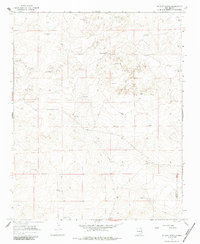
McCloy Ranch serves as the namesake for this high-plains landscape in eastern New Mexico, where the primary infrastructure consists of a extensive network of water sources. The map documents the vital water locations required for ranching in this arid environment, ranging from the Old Church Well and Willis Well in the south to Sand Hill Well in the north. The presence of Jeep Trails and fine red dashed lines indicating fence lines illustrate the managed nature of this range land. A notable boundary between Harding Co and Quay Co crosses the southeastern corner, while specialized landmarks like Whorial Blanca Well and North Orphan Well provide specific points of reference for local historians and genealogists researching the cattle operations of the mid-1960s. The landscape is defined by its reliance on these established wells, including the Old Northwest Well and North Well, which likely anchored the operations of the era.
Find a feature on this map
26 named features on this map. Tap any name to fly to it.
Don’t see what you’re looking for? This feature index may not catch every label — zoom into the map to look around manually.
Map Details
Editions of this 1966 Mc Cloy Ranch Map
2 editions found
Other maps of this area

1954 · Tucumcari
USGS Topo · 1:250,000

1958 · Tucumcari
USGS Topo · 1:250,000

1966 · Rosebud
USGS Topo · 1:24,000

1966 · Ione
USGS Topo · 1:24,000

1966 · Cherokee Valley
USGS Topo · 1:24,000

1966 · Lockney
USGS Topo · 1:24,000

1966 · Mc Carty Ranch
USGS Topo · 1:24,000

1969 · Gallegos NE
USGS Topo · 1:24,000
1969 · Fuentes Ranch
USGS Topo · 1:24,000
1973 · Indian Bathtub
USGS Topo · 1:24,000