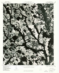
1976 Map of Mc Coll
USGS Topo · Published 1978About this map
Mc Coll stands as the central hub of this orthophotoquad, which uses aerial photography from February 1976 to reveal the intricate land-use patterns on the South Carolina and North Carolina border. The landscape is characterized by a stark contrast between dense agricultural clearing and dark, winding wetlands or wooded bays. Significant rural junctions such as Masons Crossroads and Adamsville Crossroads anchor the surrounding countryside, providing geographical touchstones for local history and property research. Further south, the settlement of Tatum appears along the primary transit corridor, showing the residential and commercial footprints of the mid-1970s. This specific type of imagery, processed by the Geological Survey, preserves the exact texture of the fields and forest lines as they existed before decades of modern development altered the rural Marlboro County terrain.
Find a feature on this map
4 named features on this map. Tap any name to fly to it.
Don’t see what you’re looking for? This feature index may not catch every label — zoom into the map to look around manually.
Map Details
Editions of this 1976 Mc Coll Map
This is the sole edition of this map. No revisions or reprints were ever made.
Other maps of this area

1942 · Rockingham
USGS Topo · 1:125,000

1949 · Gibson
USGS Topo · 1:24,000

1949 · Ghio
USGS Topo · 1:24,000

1949 · Laurinburg
USGS Topo · 1:24,000

1949 · Hamlet
USGS Topo · 1:62,500

1949 · Laurinburg
USGS Topo · 1:62,500

1953 · Florence
USGS Topo · 1:250,000

1954 · Florence
USGS Topo · 1:250,000

1957 · Laurinburg
USGS Topo · 1:24,000

1971 · Minturn
USGS Topo · 1:24,000