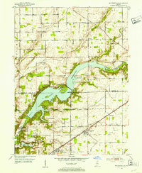
1952 Map of Mc Cordsville
USGS Topo · Published 1953About this map
Geist Reservoir dominates the central landscape of this 1952 survey, its jagged shoreline reaching into the corners of Hamilton, Marion, and Hancock counties. The map captures a transitional era for the region, where the developing residential enclaves of Rainbow Highlands and Indian Lake sit alongside established agricultural communities. To the south, the sprawling grounds of Fort Benjamin Harrison and the Indian Lake Country Club indicate the growing influence of Indianapolis.
Find a feature on this map
57 named features on this map. Tap any name to fly to it.
Don’t see what you’re looking for? This feature index may not catch every label — zoom into the map to look around manually.
Map Details
Editions of this 1952 Mc Cordsville Map
2 editions found
Other maps of this area

1948 · Indianapolis East
USGS Topo · 1:24,000

1952 · Cumberland
USGS Topo · 1:24,000

1952 · Greenfield
USGS Topo · 1:24,000

1952 · Fishers
USGS Topo · 1:24,000

1952 · Ingalls
USGS Topo · 1:24,000

1952 · Mc Cordsville
USGS Topo · 1:24,000

1953 · Lapel
USGS Topo · 1:24,000

1953 · Riverwood
USGS Topo · 1:24,000

1953 · Noblesville
USGS Topo · 1:24,000

1953 · Cincinnati
USGS Topo · 1:250,000