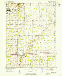
1962 Map of Mc Cordsville
USGS Topo · Published 1982About this map
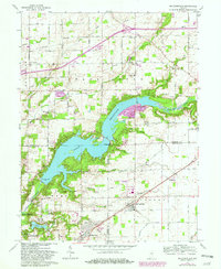
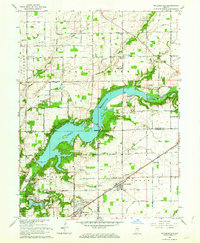
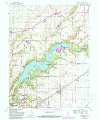
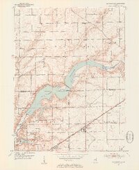
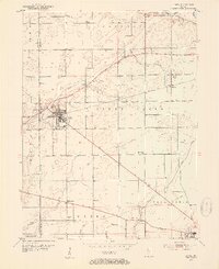
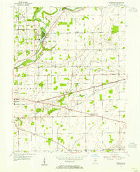
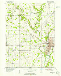
Geist Reservoir dominates this landscape, its sprawling waters filling the valley where Fall Creek and its tributaries converge. Created by damming the creek, the reservoir's shoreline is dotted with local landmarks like the Indianapolis Sailing Club and the residential area of Luxhaven. To the south, the Fort Benjamin Harrison Military Reservation borders Indian Lake, while the Conrail rail line passes through the crossroads of McCordsville and Oaklandon. The map preserves the locations of numerous family-named burial grounds, including the Kinnamon and McKay cemeteries, reflecting the area's rural history before suburban growth. Small-scale industry is visible at the Gravel Pit near Highland Cemetery and a Gas Well near the North Fork. Aerial revisions in the late 1970s trace the expansion of neighborhoods like Hawthorn Hills and Rainbow Highlands.
Find a feature on this map
66 named features on this map. Tap any name to fly to it.
Don’t see what you’re looking for? This feature index may not catch every label — zoom into the map to look around manually.
Map Details
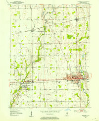
Editions of this 1962 Mc Cordsville Map
3 editions found
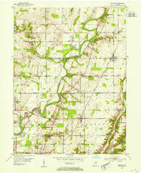
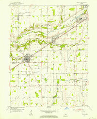
Other maps of this area
1948 · Indianapolis East
USGS Topo · 1:24,000
1952 · Cumberland
USGS Topo · 1:24,000
1952 · Greenfield
USGS Topo · 1:24,000
1952 · Fishers
USGS Topo · 1:24,000
1952 · Ingalls
USGS Topo · 1:24,000
1952 · Mc Cordsville
USGS Topo · 1:24,000
1953 · Lapel
USGS Topo · 1:24,000
1953 · Riverwood
USGS Topo · 1:24,000
1953 · Noblesville
USGS Topo · 1:24,000

1953 · Cincinnati
USGS Topo · 1:250,000