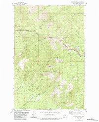
1984 Map of Mc Cormick Peak
USGS Topo · Published 1984About this map
Reservation Divide serves as the prominent boundary line on this topographical study, separating the Flathead Indian Reservation to the north from the Lolo National Forest to the south. The landscape is defined by the high elevations of Mc Cormick Peak, Blackrock Peak, and Josephine Peak, with numerous drainage systems like West Fork Revais Creek and Mc Cormick Creek carving through the mountain slopes.
Find a feature on this map
22 named features on this map. Tap any name to fly to it.
Don’t see what you’re looking for? This feature index may not catch every label — zoom into the map to look around manually.
Map Details
Editions of this 1984 Mc Cormick Peak Map
This is the sole edition of this map. No revisions or reprints were ever made.
Other maps of this area

1956 · Wallace
USGS Topo · 1:250,000

1959 · Tarkio
USGS Topo · 1:62,500

1959 · Alberton
USGS Topo · 1:62,500

1959 · Perma
USGS Topo · 1:62,500

1960 · Wallace
USGS Topo · 1:250,000

1964 · Dixon
USGS Topo · 1:24,000

1964 · Mc Donald
USGS Topo · 1:24,000
1983 · Stark South
USGS Topo · 1:24,000

1984 · Stark North
USGS Topo · 1:24,000
1984 · Huson
USGS Topo · 1:24,000