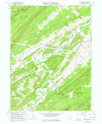
1960 Map of Mc Coysville
USGS Topo · Published 1977About this map
The ridge-and-valley topography of Juniata County is sharply defined in this 1960s-era study, where the Tuscarora Creek carves a winding path through a landscape of historic mills and small agricultural settlements. Central to the map is the village of McCoysville, supported by a network of rural landmarks such as the McCoysville Cem and nearby Rock Ch. The local economy of the mid-20th century is evidenced by the persistence of place names like Doyles Mills and McCullochs Mills, marking the traditional centers of trade and milling along the creek's many tributaries.
Find a feature on this map
53 named features on this map. Tap any name to fly to it.
Don’t see what you’re looking for? This feature index may not catch every label — zoom into the map to look around manually.
Map Details
Editions of this 1960 Mc Coysville Map
3 editions found
Other maps of this area

1919 · Mattawana
USGS Topo · 1:62,500

1924 · Lewistown
USGS Topo · 1:62,500

1925 · Mifflintown
USGS Topo · 1:48,000

1927 · Lewisburg
USGS Topo · 1:62,500

1930 · Loysville
USGS Topo · 1:62,500

1933 · Loysville
USGS Topo · 1:62,500

1934 · Mifflintown
USGS Topo · 1:62,500

1936 · East Waterford
USGS Topo · 1:48,000

1937 · Mifflintown
USGS Topo · 1:62,500

1941 · East Waterford
USGS Topo · 1:62,500
Featured Places
- Spruce Hill Township, PA
- Milford Township, PA
- Reeds Gap, Tuscarora Township
- Beale Township, PA
- Doyles Mills, Beale Township