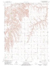
1978 Map of Mc Donald NE
USGS Topo · Published 1979About this map
The Burntwood township region in northwest Kansas is defined by the dendritic drainage patterns of the Burntwood Creek system. Branching into the West Fork Burntwood Creek and East Fork Burntwood Creek, the terrain transitions from dissected uplands to the flatter agricultural plains near Plainview. This late-1970s survey captures the intersection of traditional High Plains ranching with modern utility, marked by the presence of the Harper Landing Strip and Frisbie Landing Strip. Local history is anchored at the Mayflower Cem, while the landscape shows evidence of extractive industry through scattered Oil Wells and a Gravel Pit. The map also traces the jurisdictional borders between Rawlins, Dundy, and Hitchcock counties along the Nebraska and Kansas state line.
Find a feature on this map
16 named features on this map. Tap any name to fly to it.
Don’t see what you’re looking for? This feature index may not catch every label — zoom into the map to look around manually.
Map Details
Editions of this 1978 Mc Donald NE Map
This is the sole edition of this map. No revisions or reprints were ever made.
Other maps of this area

1950 · Mc Donald
USGS Topo · 1:62,500

1951 · Mc Donald
USGS Topo · 1:62,500

1951 · Atwood
USGS Topo · 1:62,500

1954 · McCook
USGS Topo · 1:250,000

1954 · Goodland
USGS Topo · 1:250,000

1956 · Goodland
USGS Topo · 1:250,000

1957 · McCook
USGS Topo · 1:250,000

1957 · Goodland
USGS Topo · 1:250,000

1958 · McCook
USGS Topo · 1:250,000

1962 · Trenton SW
USGS Topo · 1:24,000