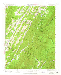
1944 Map of Mc Dowell
USGS Topo · Published 1965About this map
Shenandoah Mountain and the high ridges of the Alleghenies dominate this 1944 survey, revealing a landscape defined by isolated valleys and a sparse network of mountain schools and churches. The historic Parkersburg and Staunton Turnpike cuts across the center, a vital artery connecting the small communities of Mc Dowell and Headwaters. In the northern section, local life is anchored by institutions like the Mt Hall Sch and St Pauls Ch, while industrial history is represented by Sirons Mill along the Bullpasture River.
Find a feature on this map
119 named features on this map. Tap any name to fly to it.
Don’t see what you’re looking for? This feature index may not catch every label — zoom into the map to look around manually.
Map Details
Editions of this 1944 Mc Dowell Map
2 editions found

Other maps of this area

1889 · Beverly
USGS Topo · 1:125,000

1892 · Beverly
USGS Topo · 1:125,000

1892 · Franklin
USGS Topo · 1:125,000

1894 · Staunton
USGS Topo · 1:125,000

1896 · Franklin
USGS Topo · 1:125,000

1901 · Monterey
USGS Topo · 1:125,000

1922 · Fort Seybert
USGS Topo · 1:48,000

1922 · Spruce Knob
USGS Topo · 1:48,000

1922 · Circleville
USGS Topo · 1:62,500

1924 · Circleville
USGS Topo · 1:48,000