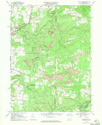
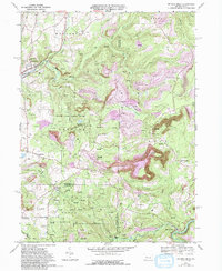
1968 Map of Mc Gees Mills
USGS Topo · Published 1971About this map
McGees Mills sits at the confluence of the W Br Susquehanna River and Bear Run, anchored by a notable Covered Bridge during this late 1960s survey. The landscape is a complex intersection of the extractive economy and conservation, with extensive Strip Mine operations and numerous gas wells neighboring State Game Lands No 195 and No 174. The Baltimore And Ohio and Penn Central railroads navigate the winding creek valleys, connecting settlements like Big Run and Bowersville. Cultural landmarks such as Mt Pleasant Ch and cemeteries including Clover Run Cem and Otterbein Ch Cem provide essential anchor points for genealogists tracing family histories in the townships of Bell, Gaskill, and Henderson. The presence of the Punxsutawney Reservoir and a high-elevation Radio Tower reflect the mid-century infrastructure supporting the surrounding rural communities.
Find a feature on this map
46 named features on this map. Tap any name to fly to it.
Don’t see what you’re looking for? This feature index may not catch every label — zoom into the map to look around manually.
Map Details
Editions of this 1968 Mc Gees Mills Map
5 editions found
Other maps of this area

1903 · Curwensville
USGS Topo · 1:62,500

1906 · Punxsutawney
USGS Topo · 1:62,500

1922 · Du Bois
USGS Topo · 1:62,500

1924 · Du Bois
USGS Topo · 1:62,500

1929 · Penfield
USGS Topo · 1:62,500

1932 · Penfield
USGS Topo · 1:62,500

1939 · Curwensville
USGS Topo · 1:62,500

1939 · Punxsutawney
USGS Topo · 1:62,500

1942 · Curwensville
USGS Topo · 1:62,500

1942 · Punxsutawney
USGS Topo · 1:62,500
Featured Places
- Gaskill Township, PA
- Banks Township, PA
- Hillman, Banks Township
- Sidney, Banks Township
- Keal Run, Banks Township