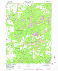
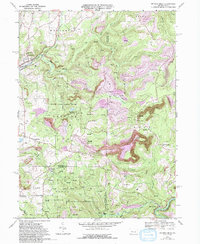
1968 Map of Mc Gees Mills
USGS Topo · Published 1982About this map
The West Branch Susquehanna River winds through this rugged portion of the Appalachian Plateaus, where the borders of Jefferson, Indiana, and Clearfield counties converge. The landscape is defined by the heavy footprint of the energy industry, with numerous gas wells and expansive strip mines terracing the hillsides. The settlement of McGees Mills sits at a strategic bend in the river, notable for its historic Covered Bridge and the presence of the Conrail line.
Find a feature on this map
47 named features on this map. Tap any name to fly to it.
Don’t see what you’re looking for? This feature index may not catch every label — zoom into the map to look around manually.
Map Details
Editions of this 1968 Mc Gees Mills Map
5 editions found
Other maps of this area

1903 · Curwensville
USGS Topo · 1:62,500

1906 · Punxsutawney
USGS Topo · 1:62,500

1922 · Du Bois
USGS Topo · 1:62,500

1924 · Du Bois
USGS Topo · 1:62,500

1929 · Penfield
USGS Topo · 1:62,500

1932 · Penfield
USGS Topo · 1:62,500

1939 · Curwensville
USGS Topo · 1:62,500

1939 · Punxsutawney
USGS Topo · 1:62,500

1942 · Curwensville
USGS Topo · 1:62,500

1942 · Punxsutawney
USGS Topo · 1:62,500
Featured Places
- Gaskill Township, PA
- Banks Township, PA
- Hillman, Banks Township
- Sidney, Banks Township
- Keal Run, Banks Township