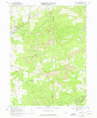
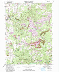
1968 Map of Mc Gees Mills
USGS Topo · Published 1975About this map
Mc Gees Mills stands as a focal point in the southeast corner of this survey, where the Penn Central railroad crosses the West Branch Susquehanna River. The landscape is a complex intersection of industry and natural resources, evidenced by the numerous Gas Wells and extensive Strip Mines that carve through the hills of Bell and Gaskill townships. These excavations sit alongside large conservation tracts like State Game Lands No 195, illustrating the region's historical reliance on coal and natural gas extraction.
Find a feature on this map
45 named features on this map. Tap any name to fly to it.
Don’t see what you’re looking for? This feature index may not catch every label — zoom into the map to look around manually.
Map Details
Editions of this 1968 Mc Gees Mills Map
5 editions found
Other maps of this area

1903 · Curwensville
USGS Topo · 1:62,500

1906 · Punxsutawney
USGS Topo · 1:62,500

1922 · Du Bois
USGS Topo · 1:62,500

1924 · Du Bois
USGS Topo · 1:62,500

1929 · Penfield
USGS Topo · 1:62,500

1932 · Penfield
USGS Topo · 1:62,500

1939 · Curwensville
USGS Topo · 1:62,500

1939 · Punxsutawney
USGS Topo · 1:62,500

1942 · Curwensville
USGS Topo · 1:62,500

1942 · Punxsutawney
USGS Topo · 1:62,500
Featured Places
- Gaskill Township, PA
- Banks Township, PA
- Hillman, Banks Township
- Sidney, Banks Township
- Keal Run, Banks Township