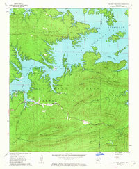
1962 Map of Mc Graw Mountain
USGS Topo · Published 1963About this map
Lake Ouachita dominates the northern landscape of this 1962 survey, its irregular shoreline creating numerous peninsulas and sheltered coves within the Ouachita National Forest. The map documents a transition in land use, where established mountain settlements like Joplin and the area near Buckville are surrounded by rising recreation interest, evidenced by the Housley Point Recreation Area and Tompkins Bend Recreation Area.
Find a feature on this map
32 named features on this map. Tap any name to fly to it.
Don’t see what you’re looking for? This feature index may not catch every label — zoom into the map to look around manually.
Map Details
Editions of this 1962 Mc Graw Mountain Map
3 editions found

Other maps of this area

1890 · Mount Ida
USGS Topo · 1:125,000

1890 · Hot Springs
USGS Topo · 1:125,000

1894 · Hot Springs
USGS Topo · 1:125,000

1906 · Caddo Gap
USGS Topo · 1:125,000

1936 · Glenwood
USGS Topo · 1:48,000

1942 · Glenwood
USGS Topo · 1:62,500

1949 · Glenwood
USGS Topo · 1:62,500

1955 · Little Rock
USGS Topo · 1:250,000

1956 · Little Rock
USGS Topo · 1:250,000

1959 · Mount Ida
USGS Topo · 1:62,500