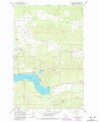
1964 Map of Mc Gregor Peak
USGS Topo · Published 1984About this map
Mc Gregor Lake serves as the focal point for this wilderness landscape in the northern Rockies, situated where the Kootenai National Forest meets the Lolo National Forest. The map documents a rugged pocket of western Montana where early recreation and resource management intersect, evidenced by Paradise Lodge and Boisvert Camp along the lake's northern shore. High-elevation features like Mcgregor Peak tower over a network of Pack Trails, including the Castle Rock (Pack) Trail, which provided essential access before modern road networks were fully established.
Find a feature on this map
17 named features on this map. Tap any name to fly to it.
Don’t see what you’re looking for? This feature index may not catch every label — zoom into the map to look around manually.
Map Details
Editions of this 1964 Mc Gregor Peak Map
2 editions found
Other maps of this area

1956 · Wallace
USGS Topo · 1:250,000

1957 · Kalispell
USGS Topo · 1:250,000

1960 · Kalispell
USGS Topo · 1:250,000

1960 · Wallace
USGS Topo · 1:250,000

1961 · Kalispell
USGS Topo · 1:250,000

1964 · Meadow Peak
USGS Topo · 1:24,000
1964 · Pleasant Valley Mountain
USGS Topo · 1:24,000

1964 · Hubbart Reservoir
USGS Topo · 1:24,000
1964 · Shroder Creek
USGS Topo · 1:24,000

1964 · Murr Peak
USGS Topo · 1:24,000