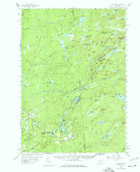
1958 Map of Mc Keever
USGS Topo · Published 1977About this map
Adirondack State Park dominates this mid-century landscape, where the heavy woods are interlaced with complex water systems and small, specialized settlements. The New York Central railroad provides the primary industrial spine, running through the heart of the territory and serving the community at McKeever. To the north, Thendara stands as a key gateway, while the southern reaches near Woodgate show a cluster of institutional sites such as the Masonic Home Camp, Holiday House, and Camp Nazareth.
Find a feature on this map
166 named features on this map. Tap any name to fly to it.
Don’t see what you’re looking for? This feature index may not catch every label — zoom into the map to look around manually.
Map Details
Editions of this 1958 Mc Keever Map
4 editions found
Other maps of this area

1897 · Remsen
USGS Topo · 1:62,500

1900 · Remsen
USGS Topo · 1:62,500

1900 · Wilmurt
USGS Topo · 1:62,500

1901 · Old Forge
USGS Topo · 1:62,500

1902 · Wilmurt
USGS Topo · 1:62,500

1903 · Big Moose
USGS Topo · 1:62,500

1904 · Boonville
USGS Topo · 1:62,500

1905 · Port Leyden
USGS Topo · 1:62,500

1907 · Port Leyden
USGS Topo · 1:62,500

1911 · Lowville
USGS Topo · 1:62,500