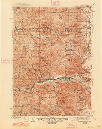
1940 Map of Mc Kenzie Bridge
USGS Topo · Published 1948About this map
Foley Ridge and the upper McKenzie River corridor define this 1940s landscape, documented during a period when the high Cascades were primarily a domain of mountain resorts, mining claims, and forestry camps. The map traces the early recreational and industrial footprint along the river, highlighting the established settlement at McKenzie Bridge and the nearby Foley Springs resort. To the west, the mining history of the region is preserved through the locations of the Lucky Boy Mine, Cinderella Mine, and Rialto Mine near Gold Hill. Extensive trail networks and guard stations like the East Fork Guard Sta reflect the management of the Willamette NF. Numerous remote camps, including Shed Camp and French Pete Camp, along with isolated family landmarks like Cooks Ranch and Hardy Cabin, provide specific points of interest for genealogists and local historians tracking early twentieth-century activity in the Willamette National Forest.
Find a feature on this map
184 named features on this map. Tap any name to fly to it.
Don’t see what you’re looking for? This feature index may not catch every label — zoom into the map to look around manually.
Map Details
Editions of this 1940 Mc Kenzie Bridge Map
3 editions found

Other maps of this area

1925 · Waldo Lake
USGS Topo · 1:125,000

1927 · Mt. Jefferson
USGS Topo · 1:125,000

1929 · Mill City
USGS Topo · 1:125,000

1929 · Three Sisters
USGS Topo · 1:125,000

1930 · Maiden Peak
USGS Topo · 1:125,000

1930 · Mt. Jefferson
USGS Topo · 1:125,000

1932 · Three Sisters
USGS Topo · 1:125,000

1934 · Maiden Peak
USGS Topo · 1:125,000

1934 · Mc Kenzie Bridge
USGS Topo · 1:96,000

1935 · Lowell
USGS Topo · 1:96,000