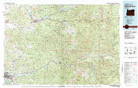
1983 Map of Mc Kenzie River
USGS Topo · Published 1984About this map
Sweet Home and Springfield anchor this 1983 topographic study of the western Cascades, where the timber and water resources of Linn County and Lane County are on full display. The map documents a landscape defined by significant 20th-century water management projects, including the impoundments of Foster Lake, Green Peter Lake, and Cougar Reservoir. These reservoirs sit amidst the expansive Willamette National Forest, contrasting with the more settled river valleys to the west.
Find a feature on this map
47 named features on this map. Tap any name to fly to it.
Don’t see what you’re looking for? This feature index may not catch every label — zoom into the map to look around manually.
Map Details
Editions of this 1983 Mc Kenzie River Map
This is the sole edition of this map. No revisions or reprints were ever made.
Other maps of this area

1909 · Rowland
USGS Topo · 1:31,680

1910 · Eugene
USGS Topo · 1:62,500

1911 · Brownsville
USGS Topo · 1:31,680

1911 · Lebanon
USGS Topo · 1:31,680

1911 · Tangent
USGS Topo · 1:31,680

1912 · Halsey
USGS Topo · 1:62,500

1916 · Albany
USGS Topo · 1:62,500

1921 · Brownsville
USGS Topo · 1:62,500

1921 · Lebanon
USGS Topo · 1:62,500

1921 · Cottage Grove
USGS Topo · 1:62,500