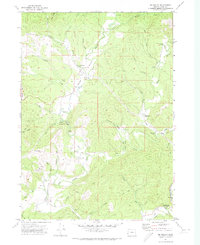
1971 Map of Mc Kinley
USGS Topo · Published 1973About this map
Fairview and McKinley serve as the primary nodes of settlement along the winding corridors of the North Fork Coquille River and its many tributaries. In the early 1970s, the landscape was a mosaic of timbered ridges and valley floors where the Wagon Road and various pack trails indicate a history of rugged access. The map captures several critical river crossings including the Fairview Bridge, Lone Pine Bridge, and Fox Bridge, marking the essential infrastructure of this river-driven economy. Genealogists will find interest in the Fairview Cem and the Pleasant Hill School, while the presence of a Gaging Station and several quarries indicates the active management and extraction occurring within the drainage basins. Public lands are well-defined by Rock Prairie County Park and Middle Creek County Park, which flank the central valley system of Lee Valley.
Find a feature on this map
62 named features on this map. Tap any name to fly to it.
Don’t see what you’re looking for? This feature index may not catch every label — zoom into the map to look around manually.
Map Details
Editions of this 1971 Mc Kinley Map
This is the sole edition of this map. No revisions or reprints were ever made.
Other maps of this area

1896 · Coos Bay
USGS Topo · 1:125,000

1898 · Coos Bay
USGS Topo · 1:125,000

1900 · Coos Bay
USGS Topo · 1:125,000

1928 · Sitkum
USGS Topo · 1:125,000

1942 · Coquille
USGS Topo · 1:62,500

1942 · Coos Bay
USGS Topo · 1:62,500

1945 · Coquille
USGS Topo · 1:62,500

1945 · Coos Bay
USGS Topo · 1:62,500

1954 · Coos Bay
USGS Topo · 1:250,000

1955 · Ivers Peak
USGS Topo · 1:62,500