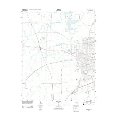
2013 Map of McAlester
USGS Topo · Published 2013About this map
The northern reaches of the city of McAlester and the settlement of Frink anchor this Pittsburg County survey. The landscape is defined by the intersection of major transit corridors like the Indian Nation Tpke S and the expansive infrastructure of the Mc Alester Regional Airport. Several distinct burial grounds are documented here, including the Prison Cem near Prison Lake, the Central State Hospital Annex Cem, and family-named sites such as Haile Cem and Tannehill Cem. To the north, Lake Talawanda Number 1 and Lake Talawanda Number Two provide significant water storage amidst a network of creeks like Rabbit Cr and Sandy Cr. The transition from the urban grid of North McAlester, featuring the American Beauty Institute, to the rising elevation of Bald Mtn illustrates the varied geography of this Oklahoma region.
Find a feature on this map
128 named features on this map. Tap any name to fly to it.
Don’t see what you’re looking for? This feature index may not catch every label — zoom into the map to look around manually.
Map Details
Editions of this 2013 McAlester Map
This is the sole edition of this map. No revisions or reprints were ever made.
Other maps of this area

1898 · McAlester
USGS Topo · 1:125,000

1900 · Canadian
USGS Topo · 1:125,000

1909 · Mc Alester
USGS Topo · 1:125,000

1946 · Fort Smith
USGS Topo · 1:250,000

1950 · Mcalester
USGS Topo · 1:250,000

1962 · McAlester
USGS Topo · 1:250,000

1965 · Fort Smith
USGS Topo · 1:250,000

1965 · McAlester
USGS Topo · 1:250,000
1966 · Haywood
USGS Topo · 1:24,000

1967 · Fort Smith
USGS Topo · 1:250,000