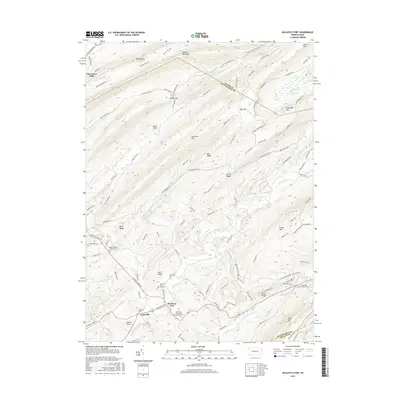
2016 Map of McAlevys Fort
USGS Topo · Published 2016About this map
McAlevys Fort and Ennisville anchor this 2016 study of the Ridge-and-Valley Appalachians along the Standing Stone Creek corridor. The geography is defined by high ridgelines like Tussey Mountain and Greenlee Mtn, which separate agricultural valleys from the densely wooded heights of the Seven Mountains. This modern survey provides a clear view of the area's spiritual and genealogical history, locating چندین small burial grounds including the Saint Stephens Lutheran Cem and McAlevys Fort United Presbyterian Cem.
Find a feature on this map
107 named features on this map. Tap any name to fly to it.
Don’t see what you’re looking for? This feature index may not catch every label — zoom into the map to look around manually.
Map Details
Editions of this 2016 McAlevys Fort Map
This is the sole edition of this map. No revisions or reprints were ever made.
Other maps of this area

1908 · Bellefonte
USGS Topo · 1:62,500

1909 · Bellefonte
USGS Topo · 1:62,500

1919 · Menno
USGS Topo · 1:62,500

1924 · Centre Hall
USGS Topo · 1:62,500

1924 · Lewistown
USGS Topo · 1:62,500

1927 · Lewisburg
USGS Topo · 1:62,500

1929 · Centre Hall
USGS Topo · 1:62,500

1935 · Allensville
USGS Topo · 1:62,500

1938 · Allensville
USGS Topo · 1:62,500

1943 · Lewistown
USGS Topo · 1:125,000
Featured Places
- McAlevys Fort, Jackson Township
- Harris Township, PA
- Barree Township, PA
- Jackson Township, PA
- Union Township, PA