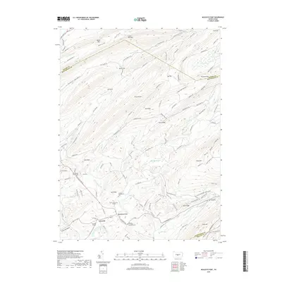
2019 Map of McAlevys Fort
USGS Topo · Published 2019About this map
Standing Stone Creek carves a central valley through this central Pennsylvania landscape, anchoring the historic crossroads of McAlevys Fort and Ennisville. The map documents a cluster of significant genealogical sites, including the McAlevys Fort United Presbyterian Cemetery and Greenlee Presbyterian Cemetery, reflecting the area's deep-rooted Scotch-Irish and German heritage. To the north, the terrain rises sharply toward Tussey Mountain and Musser Gap, while the southeastern corner is defined by the steep slopes of Stone Mountain. Between these ridges, the landscape is a network of forest trails and rural roads like Greenlee Road and Stone Creek Road. Small-scale aviation is represented by the Hostetler Airport near the southern boundary, while the northeastern quadrant includes the unique high-altitude wetlands of Bear Meadows, a rare ecological feature situated between Thickhead Mountain and Gettis Ridge.
Find a feature on this map
117 named features on this map. Tap any name to fly to it.
Don’t see what you’re looking for? This feature index may not catch every label — zoom into the map to look around manually.
Map Details
Editions of this 2019 McAlevys Fort Map
This is the sole edition of this map. No revisions or reprints were ever made.
Other maps of this area

1908 · Bellefonte
USGS Topo · 1:62,500

1909 · Bellefonte
USGS Topo · 1:62,500

1919 · Menno
USGS Topo · 1:62,500

1924 · Centre Hall
USGS Topo · 1:62,500

1924 · Lewistown
USGS Topo · 1:62,500

1927 · Lewisburg
USGS Topo · 1:62,500

1929 · Centre Hall
USGS Topo · 1:62,500

1935 · Allensville
USGS Topo · 1:62,500

1938 · Allensville
USGS Topo · 1:62,500

1943 · Lewistown
USGS Topo · 1:125,000
Featured Places
- McAlevys Fort, Jackson Township
- Harris Township, PA
- Barree Township, PA
- Jackson Township, PA
- Union Township, PA