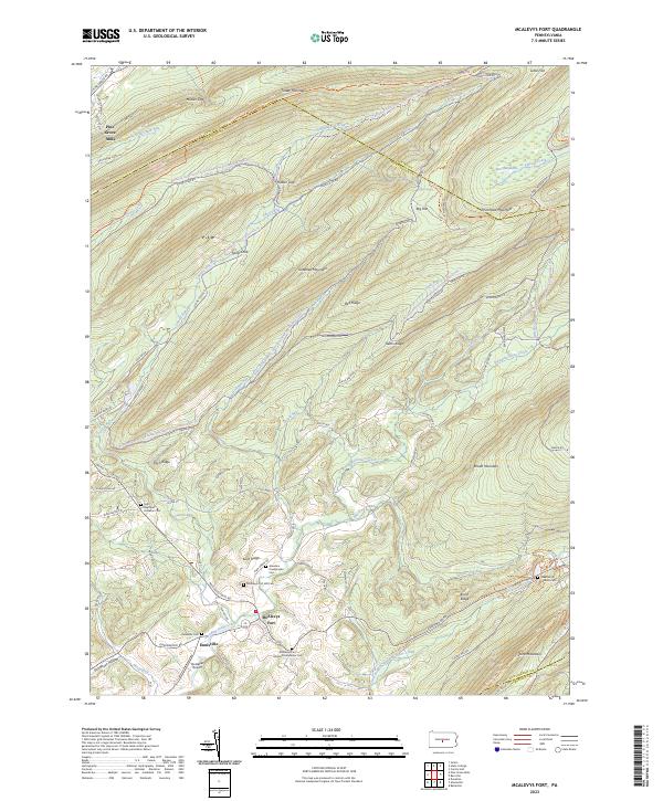
2023 Map of McAlevys Fort
USGS Topo · Published 2023About this map
Mcalevys Fort and Ennisville anchor the valley floor where Standing Stone Creek winds through southern Huntingdon County. This modern topographic view reveals a dense concentration of local heritage sites, including the Saint Stephens Lutheran Cem and several family-named burial grounds like the Mcalevys Fort Hill Cem. The terrain is defined by the sharp ridges of Tussey Mountain and Greenlee Mountain, separated by gaps such as Musser Gap and Hubler Gap. Higher elevations are preserved within the Rothrock State Forest, including the ecological unique Bear Meadows area and the broad heights of Big Flat. The transition from the rural airfields at Hostetler Airport to the wilderness of Stone Mountain illustrates the enduring balance between small-town Pennsylvania aviation, agriculture, and expansive state forest lands.
Find a feature on this map
84 named features on this map. Tap any name to fly to it.
Don’t see what you’re looking for? This feature index may not catch every label — zoom into the map to look around manually.
Map Details
Editions of this 2023 McAlevys Fort Map
This is the sole edition of this map. No revisions or reprints were ever made.
Other maps of this area

1908 · Bellefonte
USGS Topo · 1:62,500

1909 · Bellefonte
USGS Topo · 1:62,500

1919 · Menno
USGS Topo · 1:62,500

1924 · Centre Hall
USGS Topo · 1:62,500

1924 · Lewistown
USGS Topo · 1:62,500

1927 · Lewisburg
USGS Topo · 1:62,500

1929 · Centre Hall
USGS Topo · 1:62,500

1935 · Allensville
USGS Topo · 1:62,500

1938 · Allensville
USGS Topo · 1:62,500

1943 · Lewistown
USGS Topo · 1:125,000
Featured Places
- Union Township, PA
- Ferguson Township, PA
- Barree Township, PA
- Jackson Township, PA
- Ennisville, Jackson Township